Mapping Zones
The stratification of the region into mapping zones was based upon the approach adopted for the National Land Cover Dataset (2001). We have worked with the EROS Data Center (EDC) to refine those mapping zones so that they are based on eco-regional boundaries as defined by Omernik (http://www.epa.gov/wed/pages/ecoregions/ecoregions.htm).
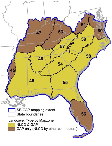
SE-GAP was responsible for mapping NLCD landcover for seven of these mapping zones, as outlined in the map below. All NLCD landcover products are available for the contiguous US from the MRLC website.
SE-GAP is producing detailed GAP landcover based on Ecological Systems for all the map zones in the map below.
 |
| ||||||||||||||||||||||||||||||||||||||||||||||||||||||||||||
For mapping zones in which other collaborators were working, the mapping zone boundaries were created by EDC and are based on both spectral and ecological homogeneity (http://landcover.usgs.gov/pdf/homer.pdf).